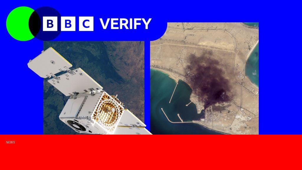
What happened
A leading satellite imagery provider has recently restricted access to high-resolution images of Iran, reportedly in response to pressure from the United States government. This move has limited the availability of up-to-date satellite data revealing key developments within Iran, including infrastructure projects and military activities. The company has confirmed it implemented stricter controls on image distribution relating to the country, citing regulatory compliance and national security concerns.
Why it matters
The restriction of satellite imagery from Iran has significant implications for journalists, researchers, and policymakers who rely on open-source intelligence to monitor developments in the region. This limitation hampers the ability to independently verify events such as nuclear program advancements and regional military deployments—critical areas of interest amid ongoing tensions between the US and Iran. Moreover, it raises concerns about the influence of government pressure on commercial satellite providers and the future accessibility of global satellite data for transparency and accountability.
Background
Satellite imagery companies have become vital players in global intelligence by providing near real-time views of various regions. Many governments and independent groups use these images to track everything from natural disasters to military actions. In recent years, escalating geopolitical friction between the US and Iran, particularly over Iran’s nuclear activities and regional influence, has intensified scrutiny of Iranian developments. The US government has previously imposed sanctions and sought to control technological exchanges with Iran as part of broader diplomatic and security strategies. This latest move reflects ongoing tensions and the complex role of private companies operating in politically sensitive areas.
Questions and Answers
Q: Which satellite provider restricted images of Iran?
A: The specific satellite imagery company has not been publicly named, but it is understood to be one of the major commercial providers with global image capabilities.
Q: What kind of images are being restricted?
A: High-resolution satellite images that provide detailed views of Iran’s infrastructure, military sites, and other strategic locations are being limited.
Q: Why did the company impose these restrictions?
A: The company cited compliance with US government regulations and national security concerns as the primary reasons for restricting access to imagery of Iran.
Q: How does this affect global monitoring efforts?
A: The restriction reduces the availability of independent data on Iran, complicating efforts by researchers, journalists, and governments to track developments accurately.
Q: Could this set a precedent for other countries?
A: Yes, there are concerns that similar restrictions could be applied to satellite imagery of other countries due to political pressures, potentially limiting transparency worldwide.
Source: https://www.bbc.com/news/articles/c5y721yqe6ro?at_medium=RSS&at_campaign=rss