What happened
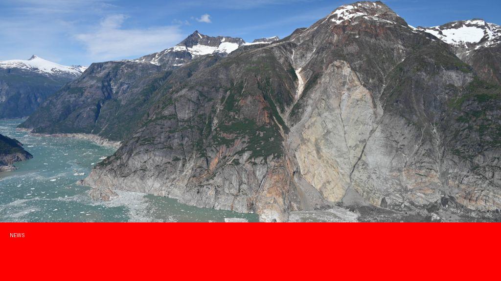
A massive megatsunami struck Alaska, generating waves that rank as the second largest ever recorded. The colossal wave was triggered by a massive landslide into a fjord, displacing an enormous volume of water and causing a towering tsunami that devastated the surrounding coastline. The event has been closely analyzed by scientists through geological evidence and computer modeling, revealing the unprecedented scale of this natural disaster.
Why it matters
This megatsunami underscores the destructive power of natural geological events and highlights the potential risk to coastal communities near unstable slopes and fjords. Understanding the mechanisms and scale of such events is crucial for improving early warning systems and preparedness strategies. The findings from this event can help scientists better predict future landslide-induced tsunamis and mitigate their impacts on human settlements and critical infrastructure.
Background
Megatsunamis are giant waves caused by large-scale landslides or volcanic eruptions rather than by undersea earthquakes. Alaska’s rugged coastline features numerous steep fjords and mountainous terrain, making it susceptible to landslides. Previously, the largest known megatsunami occurred in Lituya Bay, Alaska, in 1958, which produced a wave over 1,700 feet high. The recent event surpasses many others in terms of volume of water displaced and wave height, although it is still second to Lituya Bay’s record. Scientists have been studying sediment layers and tree damage to reconstruct the event’s dynamics.
Questions and Answers
Q: How did scientists determine the size of the Alaska megatsunami?
A: Researchers examined geological deposits, such as displaced trees and sediment layers, and used computer simulations based on landslide volume and topography to estimate the wave’s height and energy.
Q: Is this type of megatsunami common in Alaska?
A: While Alaska’s geography makes megatsunamis possible, such colossal events are rare but pose a significant threat due to the steep fjords and unstable slopes.
Q: What measures can be taken to reduce the impact of future megatsunamis?
A: Enhancing monitoring of landslide-prone areas, developing early warning systems, and establishing evacuation plans for coastal communities can help mitigate the risks.
Q: How does this megatsunami compare to the 1958 Lituya Bay event?
A: The 1958 Lituya Bay megatsunami remains the largest recorded, with wave heights over 1,700 feet. The recent event is the second largest, notable for its volume and destructive potential but slightly smaller in wave height.
Source: https://www.bbc.com/news/articles/c1m253033m4o?at_medium=RSS&at_campaign=rss