What happened
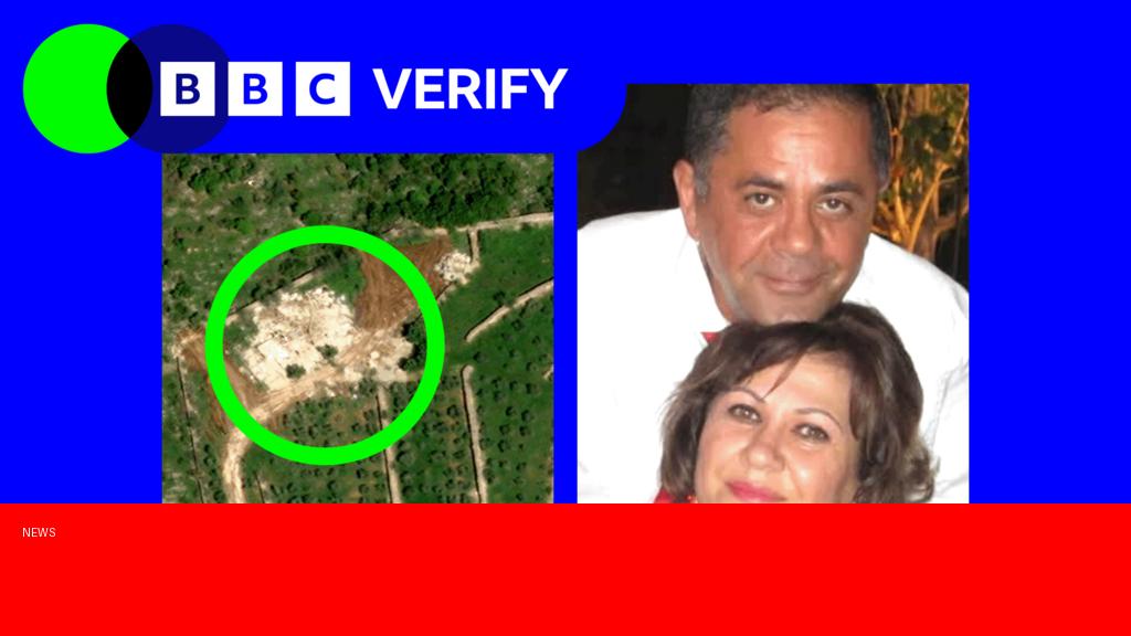
A Lebanese couple recently discovered that their family home in southern Lebanon was destroyed after they spotted the damage on a satellite image. The image, available through an online mapping service, revealed significant structural damage consistent with recent Israeli airstrikes in the area. The couple had been living abroad and only learned of the destruction through this unexpected technological means.
Why it matters
This incident highlights the growing role of satellite imagery and technology in providing real-time information in conflict zones, especially for displaced families unable to visit their homes. It underscores the human cost of ongoing tensions between Israel and Lebanon, raising international awareness of the consequences civilians face. Moreover, it may influence humanitarian efforts and calls for accountability regarding the protection of civilian properties during conflicts.
Background
Southern Lebanon has been a frequent flashpoint in the decades-long conflict between Israel and Hezbollah, a Shiite militant group based in Lebanon. Periodic escalations have resulted in airstrikes, rocket attacks, and significant civilian casualties and property damage. Recent months have seen renewed violence following cross-border incidents, leading to heightened Israeli military operations that have affected Lebanese towns and villages. Satellite imagery has increasingly become a tool used by journalists, activists, and displaced residents to monitor developments in these contested areas.
Questions and Answers
Q: How did the couple find out about the destruction of their home?
A: They discovered the damage by viewing up-to-date satellite images online that showed their house had been destroyed.
Q: What caused the destruction of the home?
A: The home was destroyed by Israeli airstrikes during recent military operations in southern Lebanon.
Q: Why couldn’t the couple see the damage in person?
A: The couple was living abroad, and due to security concerns and travel restrictions in the conflict zone, they were unable to visit their family property.
Q: How can satellite imagery help families affected by conflict?
A: Satellite images provide timely visual information about the condition of properties and infrastructure, helping families stay informed when physical access is impossible.
Q: What does this event reveal about the broader conflict between Israel and Lebanon?
A: It highlights the ongoing risks to civilian lives and homes, emphasizing the urgent need for conflict resolution and protection of non-combatants.
Source: https://www.bbc.com/news/articles/cvg30jkvklno?at_medium=RSS&at_campaign=rss